ABSTRACT
Ecosystem based approach rather than species based approach to management and conservation of marine recourses has been recognized as the sustainable way to tackle ecological complexities that apply to maintaining biodiversity. In this light Marine Protected Areas (MPAs) has gained prominence worldwide as a laudable tool for ecosystem based marine conservation and fishery management. This paper examines MPAs and suggests guidance for establishing them in Nigeria, whilst highlighting its benefits to ecosystem-based approach to coastal and marine resource such as fisheries management in Nigeria.
Key words: Marine protected areas, fisheries conservation, ecosystem based management.
Effective management of the impact of human activities on marine ecosystem and its surrounding environment has been identified as the main issue to be addressed towards achieving sustainable development of marine resource use and consequently it has been placed as priority in numerous global agreements such as the United Nations Conference on Environment and Development (UNCED) 1992. This conference produced some major agreements as regards the marine environment, which include the Rio Declaration on Environment and Development, the Framework on Climate Change; the Convention on Biological Diversity and the Agenda 21 (Cicinâ€Sain and Knecht, 1998).
Chapter 17 of the Agenda 21 of Noteworthy recognizes that the Oceans all kinds of seas, which includes enclosed and semi-enclosed seas, and coastal areas should be protected, while taking into consideration the rational use and development of their living resources (UNEP, 1992). Agenda 21 and other international instruments such as the Convention on Biological (CBD) also encourage the use of protected areas or area-based closures (FAO, 2014). The World Summit on Sustainable Development (WSSD) in Johannesburg, 2002 is the international conference that placed MPAs at the top of the international agenda. The plan of implementation of the WSSD (the Johannesburg Plan of Implementation), focused attention on MPAs by calling on nations to promote the conservation and management of important and vulnerable marine and coastal areas including “…the establishment of marine protected areas consistent with international law and based on scientific information, including representative networks by 2012”.
Other international agreements in support for MPAs include; The Convention on Wetlands of International Importance Especially as Waterfowl Habitats (Ramsar Convention) makes provision that parties should designate at least one wetland in their territories for the Ramsar list of Wetlands of International Importance. Wetland as defined by the Convention includes “areas of marine waters, the depth of which at low tides does not exceed six metre” (RCS, 2013). Guidance on site selection for their uniqueness indicates considerations as regards MPAs under the Ramsar Convention.
The Agenda also reflects the aims of fisheries management, which concerns how to achieve optimal and sustainable utilization of fishery resources for the benefit of humanity. This necessitates safeguarding ecosystems and conserving biodiversity. Provided the aims of conventional fisheries management approaches are efficiently implemented they include, regulating fishers’ behaviors and controlling fish mortality, to be able to achieve this sustainability objective. However, because of the failure of conventional measures in many cases, MPA have increasingly been promoted (FAO, 2011).
In the same vein, the desire to achieve ecosystem-based management (EBM) in the coastal region of countries of the world has been a common theme in coastal and ocean management policy discussions worldwide (Bianchi, 2008; Bianchi et al., 2008). Ecosystem based management is a form of natural resource management that has grown consistently over the last two decades. It has emerged from the common feeling that traditional types of natural resource management are not working or are ineffective and that a new, more holistic way of understanding how ecosystems work is needed (Curtin and Prellezo, 2010).
Ecosystem based management has been identified as an integrated approach that considers entire ecosystems, including humans (DeYoung, 2008). It addresses the cumulative impacts of multiple activities across space and time as it considers the connections within and among ecosystems. This all-embracing, ecological approach strives to ensure the continuance of services people want and need by maintaining healthy and productive ecosystems (ELI, 2013).
Instituting MPAs in the protection of marine biodiversity and local management of coastal and marine resources have been recognized as highly effective worldwide (Lubchenco et al., 2003; Lester et al., 2009; Cabral et al., 2014).
It is a strategy that shows commitment to ecosystem based management as it enhances conservation measures essential for the maintenance biological diversity and productivity of the marine environment.
Nigeria, a coastal state with a coastline of 853 km and a 200 nautical miles Exclusive Economic Zone (EEZ) adopted the United Nations Convention on the Law of the Sea (UNCLOS) in 1982. The coastline is faced with numerous challenges (such as climate change, flooding, overfishing, pollution from industrial, domestic and agricultural effluents) that have predisposed it to rapid and ill- managed degradation as a result of the diversified uses of the zone which includes fisheries (artisanal, industrial and aquaculture), gas exploration and exploitation, shipping, agriculture and tourism. These activities impact on the marine environment therefore, marine and coastal ecosystems will not deliver the full suite of ecosystem services upon which humans (especially the coastal communities) have come to rely.
The objectives of this paper are to give an overview of MPAs and highlight its benefits to ecosystem based approach to fisheries management in Nigeria and also suggest guidance for the establishment of MPA in Nigeria.
There have been several proposals on the promotion of MPAs notably that of the Caracas action plan that developed from the IV World Congress on National Parks and Protected Areas in 1992 (IUCN,1994). The action plan promoted the following objectives:
a) Protected areas being integrated into larger planning frameworks
b) Support for protected areas being expanded
c) The capacity to manage protected areas are strengthened
d) Expansion of international cooperation as regards financing, development and protected areas management (Gubbay, 1995).
As mentioned earlier, the need to protect or restore marine biodiversity has led to increasing calls for the establishment of MPAs. International commitments made provisions to protect 10% of the world’s coastal and marine EEZ by 2010 (CBD, Simard et al., 2016).
This deadline is already behind and this target is not close to being met, but concerted efforts are being made worldwide to improve commitments. An example of such commitment is the, goal 14.5 of the sustainable development goals (U.N., 2015) states that “By 2020, conserve at least 10% of coastal and marine areas, consistent with national and international law and based on the best available scientific information”.
Creating a MPA on the coastline of Nigeria may be a daunting task based on the fact that the marine and coastal environment has a very wide and diversified use and human population is on the increase in the country, which is causing an increase of human impacts on the marine environment and communities along the coast line have come to be highly dependent on the marine resources for their livelihood. However, with the placement of appropriate political and other institutional arrangement it can be achieved.
AN OVERVIEW OF MARINE PROTECTED AREAS
Marine protected areas are one of the tools suggested for use in Integrated Coastal Management (ICM) programs. Other tools include land-use control, permit systems and marine zoning, conflict resolution as regards resource use, planning, and fisheries management (Christie, 2005).
Protect Planet Ocean, an initiative by IUCN with the collaboration with UNEP-WCMC reports that “there are around 5000 MPAs designated around the world, that cover an area of approximately 2.85 million km2, representing 0.8% of the world's 361 million km2 of ocean, and 2.0% of the 147 million km2 of ocean under national jurisdiction of the global marine area that is protected, only 300,000km2 – that is, just under 10% of the global MPA area - is a marine reserve ('no-take' MPA)”.
The MPAs definition as developed at the 4th World Wilderness Congress and adopted by IUCN at its 17th General Assembly in 1988 is; ‘Any area of intertidal or sub-tidal terrain, together with its overlying water and associated flora, fauna, historical and cultural features, which has been reserved by law or other effective mans to protect part or all of the enclosed environment’.
Gubbay et al. (1995) reported that IUCN through its commission on National Parks and Protected Areas provided a list of categories of protected areas. These areas are managed primarily for the following:
i) Strict protection (that is, strict nature reserve/wilderness area)
ii) Ecosystem conservation and recreation (that is, national parks)
iii) Conservation of natural features (that is, natural monument)
iv) Conservation through active management (that is, habitat/species management area)
v) Landscape/seascape conservation and recreation (that is, protected land/seascape)
vi) Sustainable use of natural ecosystems (that is, managed resource protected area)’.
MPAs have multiple uses or in some cases restricted uses for example; ‘traditional fisheries and scuba diving, or combine a set of uses within a spatial zoning. Specific cases of MPAs where some form of extractive uses are prohibited include partially protected areas, fishery reserves, fishery closures, gear restriction zones and buffer zones’.
The aims of management that have led to the creation of MPAs are as follows (Claudet and Pelletier, 2004; Baker, 2004):
1) Protection and conservation of natural resources in areas that have been identified as most essential to the health of ecological diversity to safeguard their long-term viability and to preserve their genetic diversity or enable and support populations to recover to more pristine levels.
(2) Restoration of damaged or over-exploited areas identified as crucial to the survival of species, or of significant importance for the life cycles of economically important species;
(3) Improvement of the relationship between humans, environment and economic activities, by maintaining sustainable traditional uses and sustainable exploitation of resources, through the prevention of outside activities from detrimentally affecting the MPA, and by protecting and managing historical, cultural and aesthetic sites;
(4) Improvement of fishing yields, by safeguarding spawning stock biomass, through being a source of recruited and post-recruited stages for surrounding areas, by restoring the age structure of natural populations, and by acting as an insurance against mismanagement in fishing areas;
(5) Resolution of anticipated or present conflicts between coastal area users;
(6) Improvement of knowledge about marine environment by dealing with research and educational aspects; and
(7) Valuation of heritage for the local administration through tourism and economic profitability for the residents.
Marine reserves
Marine reserves are a special category of MPA. Biological resources within the reserve are usually protected through the use of restrictions and or prohibitions on fishing and the removal of disturbance of living and non-living marine resources, except as necessary for monitoring or research to evaluate the effectiveness of the reserve. Marine reserves will generally help to improve the ecosystem such as increases in stock abundance, age/size composition, spawning stock biomass, yield per recruit, and restoration of healthy trophic levels within its boundaries. Marine reserves are believed to be effective fisheries management tools based on the following:
Biomass export
It has been established by research that biomass of exploited species is generally higher within well protected MPAs (Jennings, 2001; Russ, 2002; Pelletier et al., 2008). In an ideal situation animals will prefer to move towards areas where density is low relative to available resources if this is beneficial to their fitness (Fretwell and Lucas, 1970). Therefore, it is expected that increases in density of exploited species within MPAs could enhance yields in neighboring fisheries through density dependent emigration. For example in the Tsitsikamma National Park in South Africa (established in 1964, one of the oldest reserves in the world) densities of a commercially important sparid fish, Chrysoblephus laticeps, were an estimated 42 times higher than in nearby fishing grounds (Buxton and Smale, 1989).
Egg and larvae export
Because reserves contain more and larger fish, populations protected will have the opportunity to produce more offspring than population exposed to exploitation. Increased egg output presupposes greater supply of juvenile fish to adjacent fisheries through export of offspring on ocean currents. Additionally, as protected stocks build up, the reserves are expected to supply local fisheries through density-dependent spillover of juveniles and adults into fishing grounds’ (Roberts et al., 2001).
Zoning in MPAs
Zoning can be described as a management tool for spatial control of activities within a MPA. It aimed to define activities that will be permitted including their associated conditions or prohibitions from specified geographic areas. It usually used to separate activities that are potentially conflicting and in some cases, exclusive use of an area may be granted to a particular sector of special interest.
A zoning plan typically provides for four different zones in the reserve
i) sanctuary or "no take" areas which makes provision for complete or partial protection from fishing, but allow observation and boating activities such as, swimming and diving to continue.
ii) zones designated towards habitat protection which protect sensitive habitat by forbidding high impact activities like commercial trawling, but permits recreational fishing and low impact commercial fishing to continue
iii) zones designated for general which cater for a broad range of sustainable activities
iv) special purpose zones designated for sites that may require special management arrangements such as ports or jetties.
AN OVERVIEW OF THE NIGERIAN COASTAL ENVIRONMENT
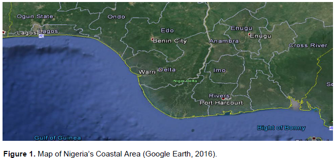
The country lies within the Gulf of Guinea Large marine Ecosystem (GCLME). Figure 1 shows Nigeria’s coastal area. Nigerian coastal zone has been classified into four geomorphic divisions, namely:
1) The Barrierâ€Lagoon Complex: The barrier-lagoon complex stretches eastward for about 200 km from the Nigeria-Benin Republic border to the western side of the Mahin transgressive mud coast. The morphology has generally been determined by coastal dynamics and drainage (Ibe, 1988). The beaches are erosive in nature due to lack of exoteric rivers which would have compensated for the sand displaced or lost due to longshore current action. The barrier-lagoon complex is supported by the Badagry Creek, the Lagos Lagoon, Lekki Lagoon and several other creeks that connect to the sea through the Commodore Channel in Lagos. The complex also consists of narrow beach ridges which are aligned parallel to the coast (Ibe, 1988).
2) Mahin Transgressive Mud Coast: This area is characterized by medium to coarse sandy beaches of Badagry, Lagos and Lekki. It is positioned eastward into mud beach off Lekki- Lagoon. The mud beach covers about 75 km and ends at the mouth of Benin River on the northwestern side of the Niger Delta. This mud coast is low lying and its almost totally devoid of sand. The absence of substantial quantities of sand on the beach and the seeming failure of longshore currents to continue the barrier island formation beyond the barrier-lagoon complex is attributed to the Avon and Mahin canyons which channel away sand to submarine fans on the slope (Burke, 1972).
3) The Strand Coast: This area covers about 85 km from Imo river estuary to the Cross-River estuary (east of the Niger Delta). The coast includes flat beaches which changes into a beach ridge plain with a few swamp systems (Burke, 1972). The swamp is linked directly with the sea at the Cross-River estuary and the Rio-del Rey estuary. The swamp systems are supported by older sediments. Two major breaks can be identified on the Strand coast, at the Kwa Iboe River and Cross-River entrances. At the entrance to the Kwa Ibo River there is a well-developed delta, while the Cross-River entrance exemplifies a typical estuarine complex.
4) The Niger Delta: The Niger Delta is a prominent geomorphic feature in the Nigerian coastal zone. It extends for about 450 km from the Benin River estuary eastward and ends at the mouth of the Imo River estuary. About 21 estuaries are said to discharge into the sea through the Delta. The Niger Delta comprises of many distinct ecological zones that includes fresh water swamp, creeks, mangroves, barrier islands and estuaries. The Niger Delta has further been classified into four major ecological zones namely; the barrier island complexes, the lower flood plain, the vegetated tidal flats and the upper flood plain (Burke, 1972; Allen, 1970).
RATIONAL FOR THE ESTABLISHMENT OF MPAS IN NIGERIA
Nigeria signed UNCLOS on the 10th of December 1982 and ratified it on the 14 August 1986; the country also ratified the agreement relating to the implementation of Part XI of the Convention on the 28 July, 1995.
As stated earlier, MPAs have been identified and proposed as flagships of marine conservation programs in many parts of the world (FAO, 2011). Establishing a MPA in Nigeria is essential due to the peculiar challenges and issues affecting coastal resource conservation (especially the fisheries) in Nigeria.
In Nigeria, approximately 25% of the country's 170 million people live in coastal areas and their livelihood is dependent on the lagoons, estuaries, creeks and inshore waters (Agbeja and Jenyo-Oni, 2013). Issues that pose as challenges to sustainable marine and coastal ecosystems in Nigeria are mostly that of environmental degradation and illegal, unreported and unregulated fishing (IUU). A study by UNEP on “Combating living resource depletion and coastal area degradation in the Guinea Current Large Marine Ecosystem (GCLME) through ecosystem-based regional actions” characterized the following issues as factors affecting conservation of coastal resources; human population growth, urbanization, habitat degradation, fisheries depletion, public health and sanitation, land use planning and coastal erosion (Ajayi, 1994). In addition to these issues, Nigeria has peculiar issues that range from civil unrest to poor political will and inconsistent policy (Afegbua, 2014).
In addition, many agricultural plantations, several harbors, airports, numerous industries as well as many other parts of the socio-economic infrastructure in Nigeria are located at or near the coast. This is ascribed to the fact that the coast is rich in natural resources and a history of early European contact in the coastal areas. (Ajetunmobi, 2012). Urbanization and development in the coastal area is also not adequately planned which promotes destruction of habitat and the poorly regularized industrialization contribute to stresses on the environment that includes pollution pressures on the coastal and international water body. These uncontrolled and poorly addressed urbanization of the coastal region leads to use conflicts that requires decisive actions to prevent civil unrest (WACAF, 1993).
There is also the issue of untreated sewage emptied into the coastal environment could invariably impact on the health of people and the environment in general. The sewage treatment facilities are inadequate in the country and especially in the coastal areas, raw sewage is discharged into the environment. The combination of these issues with the limited water exchange in the lagoons, results in pervasive eutrophication in the region (TDA, 2006).
The GCLME is rich in living marine resources especially commercially valuable fish species captured from deep sea and coastal. One million metric tons of fish are estimated to be caught annually, from the region of which a third is exported.
The extensive mangroves that occur along the Nigerian coast are the spawning grounds for numerous species of fish, including the many commercial varieties which have been degraded over the years. Mangroves of the GCLME are especially important for the coastal communities, where they are used as fuel wood for smoking fish, general household cooking, and building materials. Unfortunately, overuse and pollution (e.g. from oil spills) has severely damaged the mangroves (UNEP, 2011). Physical destruction of habitats in the coastal areas especially wetlands, result in the loss of spawning and breeding grounds for a lot of fauna, which has led to the loss of the rich biodiversity of the region including some rare and endangered species (UNEP, 2011).
In Nigeria, 33% in the Niger Delta, the mangroves and significant marshlands along the coastal area has been destroyed through pollution and overcutting (TDA, 2006; UNEP, 2011).
Urbanization and industrial growth has also led to a huge decline of mangrove to the extent that several species are said to extinct. In many instances mangrove areas, have been reduced to saline grasslands. The mangroves species that occurs in the Niger Delta of Nigeria extends from the Benin River in the West and the Calabar-Rio del Rey estuary in the East (UNDP, 2016).
Mangrove forest provide nutrients to adjacent shallow channel and bay systems- that serve as the primary habitat of numerous aquatic species of commercial importance. Besides the rich flora, there is a diverse array of associated fauna that need stringent measures towards their conservation, these include small mammals such as otters, Atilax paludinosus, Dasymys sp. and large mammals such as Cephalophus sp. Molluscs found in the GCLME include Crassostrea gasar, Arca senilis, Cymbium pepo, cones, cowries and conches (TDA, 2006). These molluscs constitute important component of fish and bird food and humans. Mangroves are home for some species of crocodiles, one is locally known as alligator, and there is also the endangered West African manatees, Trichechus Senegalensis. The mangrove forests are continually under pressure from over cutting for fuel wood and construction, and other anthropogenic activities which invariably threaten their roles in the regeneration and as reservoirs of biological diversity (UNDP, 2012).
Agriculture at subsistence and commercial levels are important to all countries in the region. The use of chemical fertilisers and pesticides in agricultural practices also impact the marine and coastal environment, and in recent years there has been noticeable increase development of commercial agriculture as there is the need to improve food production as population increases in the region (TDA, 2006).
Substantial amounts of nutrients that come from domestic and agricultural effluents, used in primary production are carried to the sea through river outflows. Approximately 30% of fertilizer applied are estimated to be actually utilised by the plants and the reminder either evaporates into the atmosphere or transported into surface waters. These excess nutrients in addition with sewage pollution, are a serious threat to lagoons (Portmann et al., 1989). These large amounts of sediments are also important sources of nutrients and suspended matter to the coastal and marine environment contributing to eutrophication and harmful algal blooms which have serious implications to ecosystem and human health.
These stresses on the environment lead to the destruction of coastal habitats and result in the loss of spawning and nursery grounds for living resources, loss of the rich and varied fauna and flora especially rare and endangered species.
Resulting impacts include decreases in the resident fish stocks near shore and the sustainability of the straddling and highly migratory fisheries of the region, both of which are of high significance towards food security and economic health to the people of the region.
Finally, there is also these risks associated with petroleum pipeline development, such as petroleum products being spilled accidental and operational discharges from shipping (e.g. ship wastes) and the accidental introduction of toxic chemicals and exotic species can seriously damage the receiving ecosystem, leading to food and habitat loss (UNEP, 2011). Harbor construction activities also alter long-shore current transport of sediments that lead to coastal erosion and siltation problems thereby placing fishing and other coastal communities in danger from loss of roadway and habitable lands.
CONSIDERATIONS FOR THE ESTABLISHMENT OF MPAS IN NIGERIA
There are no definitive models for MPAs because each nation has different social, political, economic and environmental parameters.
Protected areas; however, not new in Nigeria, are provisions regarding protection of forestry and wildlife but as at the time of this report no marine area has been designated officially for protection.
Looking at the national policy on the environment and forestry, wildlife and protected areas are part of the broad provisions of the policy, which was developed in 1989 (Federal Republic of Nigeria 1989) and later revised in 1999 (Federal Government of Nigeria 2001). The objectives of the policy are to achieve sustainable development in the country with particular emphasis on the following (Usman and Adefalu, 2010):
i) Promoting and sustaining environmental quality adequate for the health and wellbeing of all Nigerians
-Conservation of the environment and natural resources in order to benefit present and future generation of Nigerians.
ii) Restoring, maintaining and enhancing the ecosystems and ecological processes which are necessary for proper functioning of the environment.
iii) Raising public awareness and promoting public understanding of the important linkages between the environment and development.
iv) Cooperating with other countries and international organizations to preserve the environment (Usman and Adefalu, 2010) Examples of specific strategies for achieving these goals as regards protection of the forestry, wildlife include:
i) Regulation of forestry activities to ensure conservation and environmentally sound management practices.
ii) Strengthening of forest protection activities in marginal areas to prevent harmful changes in such areas.
iii) Encouraging afforestation and reforestation programmes with the aim of reversing the effects of deforestation.
iv) Supporting Non-Governmental Organizations (NGOs) and tree planting programmes of local communities.
v) Supporting the development of other alternative sources of energy while encouraging the development of more efficient way of wood energy utiization (Federal Republic of Nigeria 1989).
These existing provisions targeted towards terrestrial protected areas in Nigeria can be extended toward coastal and marine protection.
Therefore, towards designing MPAs in Nigeria, it would be beneficial to establish the following four sequential steps (NAP, 2001):
(1) Evaluate conservation needs at both local and regional levels: The intensity and method of uses of resources, the physical and biological characteristics of the habitats in a marine or coastal region of a country influence local and regional conservation needs therefore, the importance of planning an MPA cannot be overemphasized. Adequate identification and mapping of habitat types and living marine resources should be primary. There are eight coastal states in Nigeria therefore, the federal and state governments have to select the region of the country the MPA would be most appropriate based on scientific evidence and wide consultations. Local participation is of great necessity if proposal are to be successful (Agbeja, 2012). The local communities residing in the target coastal area should be involved in the selection as their cooperation will be crucial to the survival of the MPA program.
(2) Define the objectives and goals for establishing MPAs: The step is the proposal of specific management goals for the projected MPA. MPAs usually have multiple objectives which include protection of representative habitats, conserving biodiversity such as conservation of rare species, improving fishery management, protecting ecosystem integrity, fish stock restoration or enhance-ment, or safeguarding of historical sites preserving cultural heritage, providing educational and recreational opportunities, and establishing sites for scientific research etc. These objectives should be categorized and ranked based on the local conservation need, giving due consideration to conflicting objectives by establishing tradeoffs and negotiations.
When siting a MPA, biodiversity conservation is of utmost concern therefore siting criteria should include ‘habitat representation and heterogeneity, species diversity, biogeographic representation, presence of vulnerable habitats or threatened species, and ecosystem functioning. To improve fishery management, site choice may depend on the locale of stocks that are overfished to provide insurance against stock collapse or to protect spawning and nursery habitat. Site should be selected to reduce by-catch of non-target species or juveniles of exploited species’ (NAP, 2001).
(3) Describe the key biological and oceanic features of the region: Data should be generated by collecting information on the life histories of exploited or threatened species (e.g, spawning and nursery sites, dispersal patterns) and the oceanic features of the region. Information on the features of the region to be acquired should include water current and circulation patterns, identification of upwelling zones and other features associated with productivity enhancement, water quality (nutrient inputs, pollution, sedimentation, harmful algal blooms), and habitat maps. This will aid in the evaluation of the sites for its suitability and also serve as base line information that will guide future management decisions.
(4) Site Identification: Identify and choose site(s) that have the highest potential for implementation. Incorporating the desired properties of an MPA into a zoning plan that specifies size and location of reserves requires matching the biological and oceanic properties to meet the specified objectives. There is a necessity to have in place a marine spatial plan (MSP), as MSP is a process that guides where and when human activities can take place in marine spaces, so that the choice of sites for MPAs can be integrated into an overall plan for marine area management in order optimize the level of protection available to the marine ecosystem as a whole because the success of MPAs depends on the quality of management in the surrounding waters (NAP, 2011).
5) Institutional Arrangements: Federal and state/ regional agencies identified for the MPA siting will need to make available resources such as expertise and coordination so as to be able to effectively integrate MPAs into the frameworks for sustainable, ecosystem based coastal and marine resource management in order to achieve established goals at the state, regional, national, or international level. The lead agency will identify all stakeholders, both on- and off-site, and then utilize methods of communication appropriate for various user groups to optimize effort.
Designation of a MPA in Nigeria is very crucial, considering all the challenges so far discussed, so as be able to establish meaningful sustainable development of coastal and marine resource (especially fisheries) in the nation. As protected area designation is not new in Nigeria, institutional arrangements in existence can be used to support the establishment of MPAs. Establishing MPA in Nigeria may seem difficult but in my opinion, it is achievable as the usefulness of reserves MPAs as tools for environmental management cannot be over-emphasized.
The authors have not declared any conflict of interests.
REFERENCES
|
Afegbua A (2014). Conflicts and Political Instability in Nigeria: Causes, Concequences and Prospects. Politics Contemporary Political Issues and Updates.
View
|
|
|
|
Agbeja YE (2012). Enhancing Stakeholders' Participation (Co-Management) Towards Achieving Ecosystem-Based Fisheries Management in the Nigerian Coastal Fisheries. Nigerian Journal of Rural Extension and Development Vol. 67 p.
|
|
|
|
|
Agbeja YE, Jenyo-Oni A (2013). Enhancing Sustainable Livelihood in the Management of Nigerian Coastal Fisheries. Niger. J. Rural Sociol. 13(3):12.
|
|
|
|
|
Ajetunmobi RO (2012). Theories and Concepts in Migration and Settlement Studies: The case of the Coastal Yoruba. Medwell J. Soc.Sci. 7(2):289-296.
Crossref
|
|
|
|
|
Ajayi TO (1994). The Status of marine Fishery Resources of the Gulf of Guinea: In: Proc. 10th Session FAO, CECAF, Accra, Ghana, 10â€13 October 1994).
|
|
|
|
|
Allen JRL (1970). Sediments of Modern Niger Delta; a summary and review. In:Deltaic sedimentation(Ed.By J.P. Morgan). Spec. Publs. Soc. Econ. Paleont. Miner Tulsa 15:138-151.
|
|
|
|
|
Baker JL (2004). Towards a System of Ecologically Representative Marine Protected Areas in South Australian Marine Bioregions †Technical Report. Prepared for Coast and Marine Conservation Branch, Department for Environment and Heritage, South Australia.
|
|
|
|
|
Bianchi G (2008). The Concept of the Ecosystem Approach to Fisheries in FAO. The Ecosystem Approach to Fisheries. (Eds G. Bianchi and H.R. Skjoldal) pp. 20-38.
Crossref
|
|
|
|
|
Bianchi G, Sandberg P, Skjoldal HR, Thorarinsson K (2008). The Bergen Conference on Implementing the Ecosystem Approach to Fisheries (Bergen, Norway, 26-28 September 2006): Summary and Main Conclusions in The Ecosystem Approach to Fisheries. (Eds G. Bianchi and H.R. Skjoldal) pp. 1-19.
|
|
|
|
|
Burke K (1972). Longshore drift, submarine canyons and submarine fans in the development of the Niger delta. AAPG Bull. 56(10):1975-1983.
|
|
|
|
|
Buxton CD, Smale MJ (1989). Abundance and distribution patterns of three temperate marine reef fish (Teleostei: Sparidae) in exploited and unexploited areas off the southern cape coast. J. Appl. Ecol. 26:441-451.
Crossref
|
|
|
|
|
Cabral RB, Ali-o PM, Balingit ACM, Alis CM, Arceo HO, Na-ola CL, Geronimo RC, MSN Partners (2014). The Philippine Marine Protected Area (MPA) Database. Philipp. Sci. Lett. 7(2):9.
|
|
|
|
|
Christie P (2005). Is Integrated Coastal Management Sustainable? Ocean & Coastal Management 48:208-232.
Crossref
|
|
|
|
|
Cicinâ€Sain B, Knecht RW (1998). Integrated Coastal and Ocean Management: Concepts and Practices. Island Press, Washington, D.C. 517 p
|
|
|
|
|
Claudet J, Pelletier D (2004). Marine Protected areas and artificial reefs: a review of the interactions between management and scientific studies. Aquat. Living Resour.17:129â€38.
Crossref
|
|
|
|
|
Curtin R, Prellezo R (2010). Understanding marine ecosystem based management: A literature review Marine Policy 34:821-830.
Crossref
|
|
|
|
|
De Young C (2008). The Human Side of the Ecosystem Approach to Fisheries Management: Preliminary Results of an FAO Expert Consultation. In The Ecosystem Approach to Fisheries. (Eds G. Bianchi and H.R. Skjoldal) pp. 20-38.
Crossref
|
|
|
|
|
Environmental Law Institute ELI, (2013). Marine Spatial Planning & Ecosystemâ€Based Management.
View
|
|
|
|
|
Food and Agriculture Organization (2014). Marine Protected Areas as a Tool for Fisheries Management. Marine Protected Areas as a Tool for Fisheries Management (MPAs). FI Project Websites. In: FAO Fisheries and Aquaculture Department [online]. Rome. Cited April, 2014.
|
|
|
|
|
Food and Agriculture Organization. (2011) Fisheries management. 4. Marine protected areas and fisheries. FAO Technical Guidelines for Responsible Fisheries . No. 4, Suppl. 4.Rome, 198 p.
|
|
|
|
|
Fretwell SD, Lucas HL (1970). On territorial behavior and other factors influencing habitat selection in birds. Acta Biotheor. 19:16-36.
Crossref
|
|
|
|
|
Gubbay S (1995). Marine Protected Areas†Principles and Techniques for management. Chapman and Hall. 231 p.
Crossref
|
|
|
|
|
Ibe AC (1988). Coastline erosion in Nigeria. University Press, Ibadan. 217pp.
|
|
|
|
|
IUCN (1994). Caracas Action Plan, IUCN Programme on protected areas/CNPPA, Gland, Switzerland, 259 p.
|
|
|
|
|
Jennings S (2001). Patterns and prediction of population recovery in marine reserves. Rev. Fish Biol. Fish. 10:209-231.
Crossref
|
|
|
|
|
Lester SE, Halpern BS, Grorud-Colvert K, Lubchenco J, Ruttenberg BI, Gaines SD, Airam’e S, Warner RR (2009). Biological effects within no-take marine reserves: a global synthesis. Mar. Ecol. Progress Series, 384:33-46.
Crossref
|
|
|
|
|
Lubchenco J, Palunbi SD, Andelman S (2003). Plugging a hole in the ocean: the emerging science of marine reserves . Ecol. Appl. 13:S3â€S7.
Crossref
|
|
|
|
|
Marine Protected Areas: Tools for Sustaining Ocean Ecosystem. (2001). Committee on the Evaluation, Design, and Monitoring Marine Reserves and Protected Areas in the United States.
View
|
|
|
|
|
Pelletier D, Claudet J, Ferraris J, Benedetti-Cecch L, Garcis-Carton JA (2008). Models and indicators for assessing conservation and fisheries related effects of Marine Protected Areas. Can. J. Fish. Aquat. Sci. 65:765-769.
Crossref
|
|
|
|
|
Portmann JE, Biney C, Ibe C, Zabi S (1989). State of the Marine Environment in the Wsest and Central Africa Region, UNEP Regional Seas Reports and Studies, No. 108.
|
|
|
|
|
Ramsar Convention Secretariat (2013). The Ramsar Convention Manual: a guide to the Convention on Wetlands (Ramsar, Iran, 1971), 6th ed. Ramsar Convention Secretariat, Gland, Switzerland.
|
|
|
|
|
Roberts CM, Bohnsack JA, Gell F, Hawkins JP, Goodridge R (2001). Effects of marine reserves on adjacent fisheries. Science 294:1920-1923.
Crossref
|
|
|
|
|
Russ GR (2002). Yet another review of marine reserves as reef fishery management tools. In Coral Reef Fishes. Ed. P.sale. San Diego, Academic Press, pp. 421-423.
Crossref
|
|
|
|
|
Simard F, Laffoley D, Baxter JM (2016). Marine Protected Areas and Climate Change: Adaptation and Mitigation Synergies, Opportunities and Challenges. Gland, Switzerland: IUCN. 52 pp.
Crossref
|
|
|
|
|
TDA GCLME (2006). Transboundary Diagnostic Analysis in Gulf of Guinea Large marine Ecosystem.
View
|
|
|
|
|
United Nations (2015). Transforming our world: the 2030 Agenda for Sustainable Development, paragraph 54 United Nations Resolution A/RES/70/1 of 25 September 2015.
View
|
|
|
|
|
United Nations Conference on Environment & Development Rio de Janerio, Brazil, 3 to 14 June 1992 AGENDA 21, Chapter 17
View
|
|
|
|
|
United Nations Development Programme (2012). The Niger Delta Biodiversity Project.
View
|
|
|
|
|
United Nations Environment Programme (2011). Environmental Assessment of Ogoniland.
View
|
|
|
|
|
Usman BA, Adefalu LL (2010). Nigerian forestry, wildlife and protected areas: Status report. Tropical Conservancy, Biodiversity 11(3&4):9.
|
|
|
|
|
Western and Central African (WACAF) (1993). Intersecretariat Coâ€ordination Meeting, Rome.
|
|